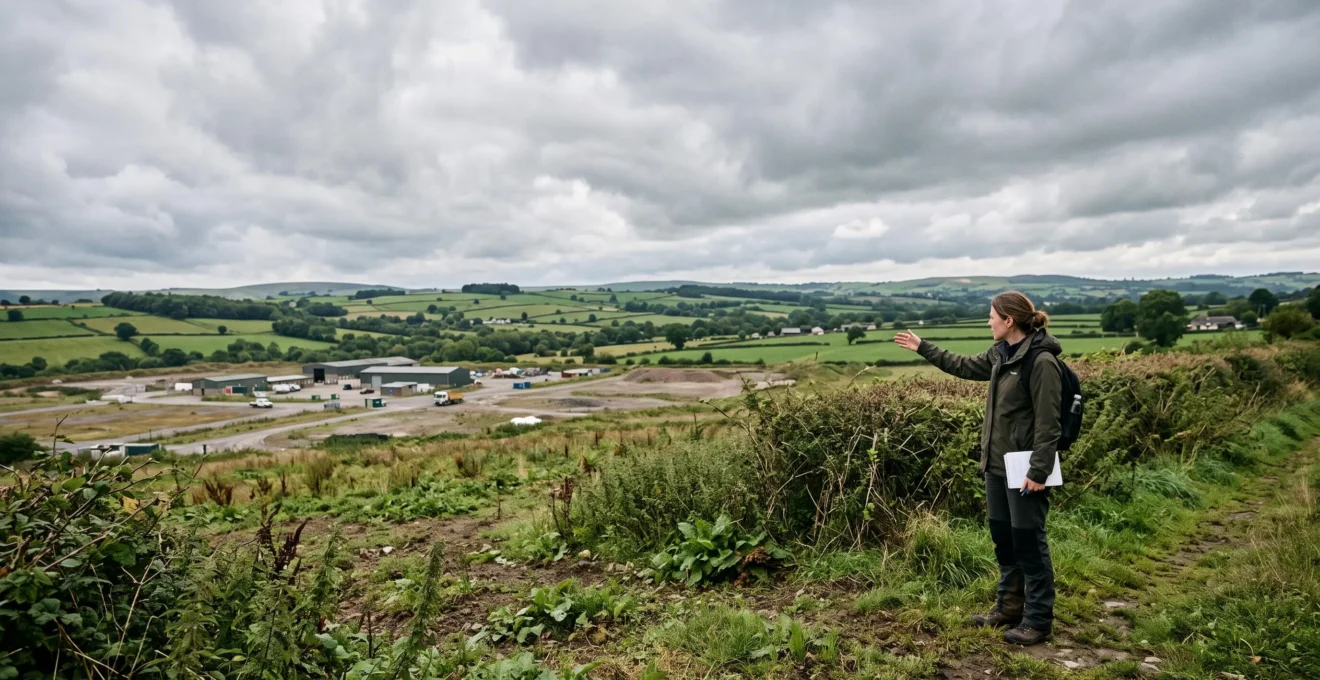
Verifying land use isn’t a procedural checkbox; it’s a strategic weapon to quantify and mitigate the hidden financial risks that turn a promising development plot into a catastrophic liability.
- The most significant financial threats often aren’t visible, such as minuscule “ransom strips,” sub-surface ground conditions, or historical contamination.
- National policy heavily favours brownfield development, but the remediation costs must be factored into your Gross Development Value (GDV) calculations from day one.
Recommendation: Shift your mindset from simply ‘checking the Local Plan’ to conducting a rigorous financial triage that stress-tests a site’s viability against these latent liabilities before committing capital.
For UK developers and investors, the acquisition of land is the moment of maximum opportunity and maximum risk. The potential for a significant return on investment is alluring, but the path from a vacant plot to a profitable development is littered with financial pitfalls. Many investors focus on the obvious: location, asking price, and the top-line potential of a finished project. They diligently check the local council’s planning portal and review the Local Plan, believing they have completed their due diligence.
This approach, however, misses the most critical point. The true art of de-risking a land purchase lies not in confirming the stated land use designation, but in unearthing the latent liabilities that don’t appear on a standard report. These are the subtle, often invisible, factors that can decimate a project’s budget and timeline. The real challenge is understanding the nuanced hierarchy of land types, the strategic game of local planning policy, and the devastating financial impact of a forgotten historical use or a tiny, un-owned strip of land.
But what if the key to protecting your investment wasn’t just about following procedure, but about adopting the mindset of a forensic analyst? This guide moves beyond the basics of planning verification. It provides a strategic framework for evaluating a site’s true development potential by focusing on the financial implications of its classification, the potential for rezoning, the spectre of contamination, and the critical importance of market alignment. It’s about learning to spot the red flags that others miss and understanding the levers that can unlock a site’s hidden value.
This article will provide a comprehensive roadmap for navigating the complexities of UK land use verification. We will dissect the critical differences between land types, explore how to influence planning outcomes, and analyse the financial metrics that determine a project’s success, ensuring you can make your next acquisition with confidence.
Summary: How to Verify Land Use Designation Before Purchasing Development Sites
- Agricultural vs Brownfield vs Greenfield: Which Land Gets Development Approval
- How to Lobby for Land Rezoning During Council Development Plan Reviews
- Residential vs Commercial Land Use: Which Delivers Better Development ROI
- The Historical Industrial Use That Makes Your Land Undevelopable Without Decontamination
- How to Match Your Land’s Permitted Use to Highest Local Market Demand
- The Planning Restriction That Makes Your £150,000 Plot Worth Only £30,000
- Why a £1,200 Ground Survey Prevents £18,000 in Foundation Redesign Costs
- How to Navigate UK Planning Restrictions Before Buying Development Land
Agricultural vs Brownfield vs Greenfield: Which Land Gets Development Approval
Understanding the fundamental classification of a plot of land is the first step in any developer’s due diligence. In the UK, the planning landscape is heavily weighted by three main categories: agricultural, greenfield, and brownfield. Each carries a distinct set of presumptions, risks, and potential rewards that directly influence the likelihood of securing development approval. The National Planning Policy Framework (NPPF) establishes a clear “brownfield first” approach, actively encouraging the reuse of previously developed land to prevent urban sprawl.
This policy is a direct response to the significant capacity of such sites. For instance, analysis confirms that in England’s brownfield land can accommodate a minimum of 1.41 million homes, making them a priority for local planning authorities (LPAs) trying to meet housing targets. For a developer, this means a brownfield site often comes with a tailwind of policy support, but this is frequently offset by the headwind of unknown remediation costs for contamination, a major financial risk.
Conversely, greenfield sites—land that has never been built on—are fiercely protected. While they may offer lower initial groundworks costs, they face significant hurdles, including strong local opposition and stringent requirements for Biodiversity Net Gain (BNG), which can add substantial cost and complexity. Agricultural land represents the highest risk and highest potential reward; securing a planning allocation to transform it from farming to development can generate enormous value uplift, but this is a long, speculative, and highly uncertain process tied to multi-year Local Plan review cycles.
A strategic developer must weigh these factors not just in terms of planning likelihood but in a full risk-reward calculus, as demonstrated in the table below which summarises the key differences.
This comparative framework helps to illustrate the strategic trade-offs involved in site selection, based on an analysis of development risk across land types.
| Land Type | Typical Planning Risk | Key Cost/Value Factor | Timescale |
|---|---|---|---|
| Agricultural | Extreme (requires allocation or rezoning) | Highest potential value uplift if allocated, but highly speculative | Long (years, dependent on Local Plan cycles) |
| Brownfield | Medium (policy support, but remediation uncertainty) | Contamination and remediation cost risk offset by government incentives | Medium, often faster due to existing infrastructure access |
| Greenfield | High (local opposition, landscape/BNG constraints) | Lower groundworks cost, but Biodiversity Net Gain adds new financial hurdles | Fastest construction once permission is secured |
Ultimately, the “best” land type depends entirely on the developer’s risk appetite, access to capital, and strategic patience. The key is to enter any negotiation with a clear-eyed understanding of the specific planning and financial battle that lies ahead.
How to Lobby for Land Rezoning During Council Development Plan Reviews
Securing a change in land use designation, particularly moving a site from agricultural or greenfield into the development boundary, is one of the most effective ways to create value. This is not a process of informal lobbying but a formal, structured engagement with a council’s Local Plan review cycle. The primary mechanism for developers and landowners is the “Call for Sites,” a public invitation from the Local Planning Authority (LPA) for submissions of land considered suitable for development.
Successfully navigating this process requires a meticulously prepared submission. It is not enough to simply offer the land; you must present a compelling planning case. This typically involves commissioning a “Vision Document” or “Planning Statement” from a reputable planning consultancy. This document must demonstrate how your site aligns with the strategic objectives of the NPPF and the emerging Local Plan. Key arguments will revolve around the site’s sustainability, deliverability, and viability.
Your submission should pre-emptively address potential constraints. This includes providing preliminary reports on access, flood risk, heritage impact, and ecology. By presenting the council with a site that is not only available but also demonstrably viable and with a clear path to overcoming constraints, you significantly increase its chances of being included in the Strategic Housing and Economic Land Availability Assessment (SHLAA/SHELAA). This assessment is the pool from which the council will draw its future allocated sites.
The process continues through formal consultation stages, typically known as Regulation 18 (draft plan) and Regulation 19 (submission plan). At these stages, you or your appointed consultant can make formal representations in support of your site’s allocation or object to competing sites. Success is a long-term game of strategic patience and providing robust evidence. The cost is not a fee to the council but the investment in professional reports and consultancy fees required to build an undeniable case for your land’s inclusion.
While there are no guarantees, a professional, evidence-led approach to engagement during the Local Plan review is the only legitimate and effective way to influence a site’s zoning and unlock its highest potential value.
Residential vs Commercial Land Use: Which Delivers Better Development ROI
Once a plot is confirmed as developable, the next critical decision is its end use. The debate between residential and commercial development is not about which is inherently “better,” but which is more strategically aligned with market conditions, planning policy, and the developer’s business model. The Return on Investment (ROI) for each is driven by vastly different factors.
Residential development ROI is primarily influenced by sales values (or rental income for build-to-rent), build costs, and the planning obligations attached, such as affordable housing contributions and Community Infrastructure Levy (CIL) payments. The market is often cyclical but benefits from persistent underlying demand for housing. A key part of the value-uplift calculus is density; maximising the number of saleable units on a site is often the primary driver of profitability. However, this is constrained by local character, design codes, and unit mix policies set by the LPA.
Commercial development, encompassing everything from industrial logistics (Use Class B8) to offices and retail (Use Class E), offers a different risk/reward profile. ROI is typically calculated on the basis of rental yield and the strength of the tenant’s covenant. A long-term lease to a blue-chip company provides a stable, predictable income stream, making the asset highly attractive to institutional investors. The market is heavily tied to economic cycles and structural shifts—for example, the recent surge in demand for logistics and warehouse space versus the decline in traditional high-street retail. The flexibility of the ‘Class E’ designation, which allows for changes between uses like shops, offices, and restaurants without a planning application, has introduced a significant new dynamic, increasing the adaptability and potential long-term value of certain commercial assets.
A sophisticated investor will often consider a mixed-use scheme, which can combine the high-value sales of residential apartments with the long-term income of ground-floor commercial units. This can de-risk a project by diversifying income streams and creating a more vibrant, integrated community that is often favoured by planning authorities. The choice is a strategic one, requiring deep analysis of local market data, tenant demand, and the specific nuances of the site and its surrounding economy.
Ultimately, the superior ROI will be delivered by the developer who correctly reads the hyper-local market signals and aligns their proposed use class with the strongest, most sustainable source of demand.
The Historical Industrial Use That Makes Your Land Undevelopable Without Decontamination
A vacant, cleared site can appear to be a blank canvas, but its history is written in the soil. The UK’s long industrial past means that many prime brownfield sites are burdened with a legacy of contamination. Ignoring this potential “latent liability” is one of the most catastrophic errors a developer can make, as the cost of remediation can easily exceed the land’s purchase price, rendering a project financially unviable overnight.
The risk is governed by Part 2A of the Environmental Protection Act 1990, which places a legal responsibility on the landowner to deal with “contaminated land.” The types of historical uses that should immediately raise red flags are extensive. Sites that previously hosted gasworks, tanneries, chemical plants, scrapyards, or even old petrol stations are highly likely to contain a cocktail of harmful substances. These can include heavy metals (like lead and arsenic), hydrocarbons, asbestos, and volatile organic compounds (VOCs).
The due diligence process here involves a phased approach. The first step is a Phase 1 Desk Study. This involves a thorough review of historical maps, environmental records, and local authority data to assess the likelihood of contamination. If this study identifies a potential risk, it is non-negotiable to proceed to a Phase 2 Intrusive Investigation before purchase. This involves physically taking soil and water samples from the site for laboratory analysis. This report will quantify the nature and extent of any contamination.
If contamination is confirmed, a Phase 3 Remediation Strategy is required, detailing how the site will be made safe for its proposed new use. This might involve anything from “capping” the contaminated soil with a clean layer to the far more expensive process of “dig and dump”—excavating and removing tons of contaminated soil to a specialist landfill. These costs are significant and must be factored into your financial appraisal. A savvy developer will use the estimated remediation cost as a powerful negotiating tool to reduce the land’s purchase price, effectively making the seller pay for their historical legacy.
Failing to investigate the ground beneath your feet is a gamble no prudent investor should ever take. The question is not *if* the site is clean, but proving it is, and quantifying the exact cost if it is not.
How to Match Your Land’s Permitted Use to Highest Local Market Demand
Securing planning permission is only half the battle. True development success comes from delivering a project that the market is actively demanding. A permitted use is worthless if there are no buyers or tenants. Therefore, strategic due diligence must extend beyond the planning department and into a rigorous analysis of local market dynamics. The goal is to find the profitable intersection between what you *can* build and what you *should* build.
For residential development, this means going deeper than a generic “demand for housing.” Your analysis must be granular. Key resources for this are the council’s own evidence base, particularly the Strategic Housing Market Assessment (SHMA). This document identifies the need for different types and sizes of homes. Are local estate agents reporting a glut of two-bedroom flats but a severe shortage of three-bedroom family homes with gardens? Is there a growing demographic of downsizing retirees looking for accessible, single-level living? Building the right product mix for the specific local demographic is paramount.
For commercial projects, the analysis is equally nuanced. An investor must look at local economic trends, infrastructure developments, and vacancy rates for similar properties. Is a new university campus or hospital creating demand for student accommodation or specialist medical suites? Is the expansion of a nearby port driving demand for logistics and warehouse space (B8 use)? Reviewing the commercial property sections of major real estate portals (like Rightmove Commercial or Zoopla) in the target postcode can provide a real-time snapshot of what is available, what is leasing quickly, and at what price point. The rental yield and vacancy rate are the two most critical metrics.
Ultimately, this market intelligence allows a developer to refine their scheme to maximise its value. It might mean tweaking the unit mix of a residential block, adjusting the size of commercial units to match local business needs, or even pivoting the entire project’s use class based on a newly identified market gap. This data-driven approach transforms a development from a speculative venture into a calculated response to a proven market need, significantly enhancing its ROI potential and reducing sales or leasing risk upon completion.
A successful project is not just well-built; it is well-conceived, answering a specific question that the local market is asking.
The Planning Restriction That Makes Your £150,000 Plot Worth Only £30,000
In the world of property development, the smallest details can have the largest financial consequences. Perhaps no single issue illustrates this better than the “ransom strip”—a small, often narrow, parcel of land owned by a third party that blocks access to a development site. Without the legal right to cross this strip, a prime plot of land can be rendered effectively landlocked and, from a development perspective, almost worthless.
The power held by the owner of a ransom strip is immense. They can prevent any access for construction vehicles, utilities, or future residents, effectively holding the entire development to ransom. This is not a theoretical problem; it is a well-established legal principle with a clear financial impact. The key is to identify any such strips during the initial title review, long before contracts are exchanged. A surveyor’s report should meticulously check that the site has direct, unimpeded access to the public highway.
When a ransom strip is identified, negotiation is the first step, but it must be based on a clear understanding of the legal and financial precedent. The starting point for any valuation is the landmark case that defines the financial implications of this issue.
Case Study: The Stokes v Cambridge Corporation (1961) Precedent
The foundational principle for valuing a ransom strip comes from the 1961 case of Stokes v Cambridge Corporation. An analysis of this legal precedent establishes that the owner of the strip is entitled to a significant share of the “development uplift” they unlock. The court held that a fair price for releasing the ransom is one-third of the increase in the value of the development land that results from gaining access. For example, if a landlocked site is worth £2 million but would be worth £8 million with access, the value uplift is £6 million. The ransom strip’s value would therefore be calculated as £2 million (one-third of £6m). This precedent demonstrates how a tiny sliver of land can capture a huge portion of a project’s profit.
This principle underscores the critical importance of early identification. Discovering a ransom strip after purchase puts the developer in an incredibly weak negotiating position. A pre-emptive, thorough title investigation is the only effective insurance against this potentially project-killing risk.
Your Action Plan: Responding to a Ransom Strip
- Identify the Threat: Conduct a meticulous search of the Land Registry title plan and map before exchange to spot any potential ransom strips and confirm if the land is registered or unregistered.
- Initiate Early Negotiation: If a strip is identified, approach the landowner for direct negotiation to purchase the strip or agree a right of way before you are legally committed to buying the development site.
- Benchmark Your Offer: Use the Stokes v Cambridge “one-third of the value uplift” principle as the primary benchmark and starting point for any financial settlement.
- Assess Legal Leverage: Investigate whether the landowner of the strip has other means of access, which could weaken their position, or if they have established rights that are difficult to challenge.
- Explore Statutory Alternatives: If negotiation fails, explore whether a Section 106 agreement or an “access order” under specific legislation could be used to compel the granting of access as a last resort.
The lesson is stark: the value of a development site is not in the land itself, but in its unencumbered potential to be developed. A ransom strip severs that potential entirely.
Why a £1,200 Ground Survey Prevents £18,000 in Foundation Redesign Costs
Beneath every potential development site lies a set of risks that can silently inflate construction costs and derail a project’s budget. The ground itself—its stability, composition, and water content—is a major variable that many novice investors overlook. Assuming the ground is “good” without verification is a speculative gamble that can lead to exorbitant costs for foundation redesign. A modest upfront investment in a geotechnical ground survey is one of the highest-ROI risk mitigation measures a developer can take.
The purpose of a ground investigation is to move from assumption to certainty. It reveals the soil’s load-bearing capacity, identifies the presence of a high water table, and flags potential issues like shrink-swell clays, peat, or uncompacted fill material. Each of these conditions requires a specific, and often more expensive, foundation solution. Standard strip foundations are cheap and easy, but they are only suitable for stable, predictable ground. Discovering halfway through the design phase that the site requires costly piled foundations or an engineered raft can add tens of thousands of pounds to a build, completely destroying the project’s financial appraisal.
The process of ground investigation is scalable. It should always begin with the simplest, cheapest step: a walkover survey to spot obvious indicators like nearby watercourses, distressed trees, or cracks in neighbouring buildings. If risks are suspected, the next step is often digging a series of trial pits to visually inspect the soil strata. Only where site history or initial findings justify it does the investigation escalate to more expensive deep exploratory boreholes, which provide a detailed core sample for laboratory analysis.
Armed with a technical report from the survey, your structural engineer can design the most efficient and economical foundation solution from the outset. As confirmed by guidance for developers, this technical report provides the reassurance that foundation budgets reflect reality, not a hopeful guess. This prevents costly redesigns, delays, and unexpected budget hikes during the construction phase. The cost of a basic survey is negligible compared to the financial black hole it can prevent you from falling into.
In development, what you don’t know can, and will, hurt you. A ground survey is the tool that replaces ignorance with data, and financial risk with engineering certainty.
Key Takeaways
- A “brownfield first” policy dominates UK planning, but these sites carry significant risk of contamination and remediation costs that must be priced in.
- Latent liabilities, such as ransom strips or poor ground conditions, are often invisible but can have a greater negative financial impact than the purchase price of the land.
– The value of a site is determined by the intersection of its permitted use and genuine, demonstrable local market demand for that specific use.
How to Navigate UK Planning Restrictions Before Buying Development Land
Successfully acquiring and developing land in the UK is less about construction and more about expertly navigating a complex web of planning laws and restrictions. For any investor, a foundational understanding of this system is not optional; it is the core of effective due diligence. The entire framework is built on a principle established by the Town and Country Planning Act 1947: any new “development” requires planning permission, unless it is specifically exempted.
This creates a critical two-stage test for any proposed project. First, is the proposal legally considered “development”? This includes building operations but also material changes in the use of land. Second, if it is development, is it “permitted development”? The government grants a blanket planning permission for certain categories of minor or common works, known as Permitted Development Rights (PDRs). These are a powerful tool, but they are riddled with exceptions, conditions, and are often removed by local authorities in specific areas (like conservation areas) via an Article 4 Direction. You can never assume PDRs apply without explicit verification.
Beyond the headline issue of permission, a site’s potential is shaped by a host of other restrictions. These can include Tree Preservation Orders (TPOs), heritage listings for buildings on or near the site, public rights of way, and restrictive covenants in the property deeds that might limit what can be built. Each of these can act as a “hard stop” on a development proposal or add significant cost and complexity to the design. A thorough developer will create a checklist of these potential restrictions and systematically work through them, seeking to clear each one before committing to the purchase.
The key to navigating this maze is to use the resources available. The Local Planning Authority’s website is the primary source, containing the Local Plan, interactive policy maps, and the public register of past planning applications on and around your site. Reviewing the Decision Notices and Officer Reports for nearby applications provides invaluable insight into the council’s interpretation of its own policies and what issues are most likely to be contentious. This forensic review of precedent is one of the most reliable predictors of your own application’s future success.
Ultimately, navigating UK planning restrictions is a process of systematic de-risking. It requires a paranoid attention to detail, a respect for legal precedent, and a clear understanding that the most expensive mistake is the one you fail to discover before you buy the land.
Frequently Asked Questions about How to Verify Land Use Designation Before Purchasing Development Sites
What is ‘permitted development’ in UK planning law?
Permitted development refers to specified categories of development that are granted an automatic planning permission by law. As a result, they do not require a formal application for planning permission, though they may still be subject to certain conditions and limitations.
Does every building project need a formal planning application?
No. For any proposal, there is a two-stage test. First, is the proposal legally defined as ‘development’? If it is, the second question is ‘is it permitted development?’. Only if a development is not classed as permitted development would a formal application for planning permission be required.
Since when has planning permission been legally required in the UK?
The modern planning system came into effect on 1 July 1948, following the Town and Country Planning Act 1947. Since that date, any new ‘development’ has required planning permission. All uses and buildings that existed before this date were granted planning title automatically.